Tag Archives: City of Hamilton

A SoBi tour with Bill Curran

IMG_4105.JPG

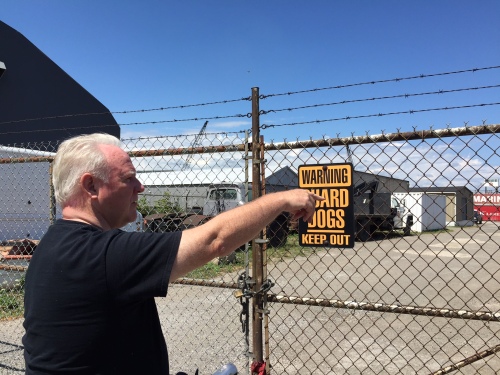
Bill Curran pointing to the landscape beyond as he discusses the surrounding neighbourhood

Architect Bill Curran and I have been planning a bike ride for some time.

We often tour around Hamilton, checking out buildings and houses, discussing architecture, the neighbourhoods, and Hamilton’s deep history. Because of how large Hamilton is geographically, we either pick a neighbourhood to walk or we end up taking a car to cover the most ground possible. This weekend we were finally able to go for a bike ride. The area we picked is one of Bill’s favourites: the industrial north.

IMG_4082.JPG

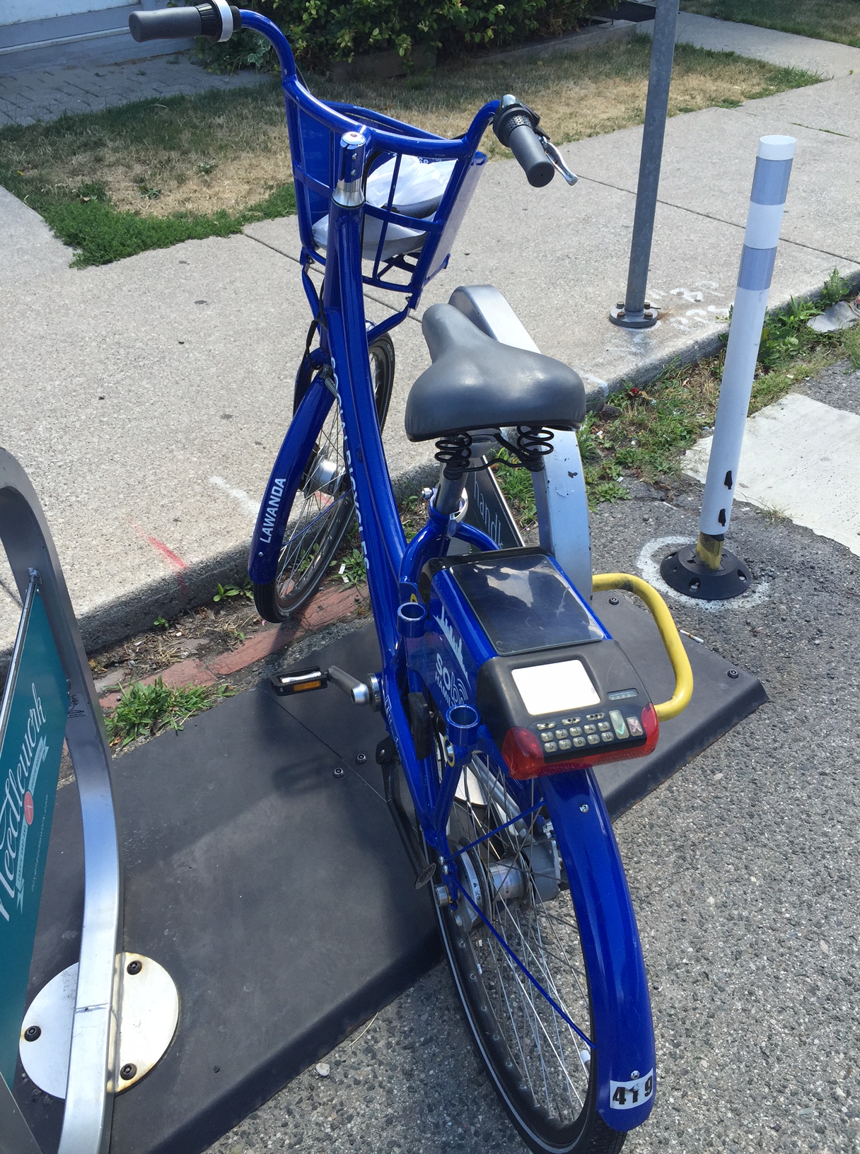
#419 Lawanda is a personal favourite at the Locke Street hub

I grabbed a SoBi (there’s a rack conveniently close to my apartment) and was on my way to meet Bill out front of his office on James Street North. He had a route in mind, but we basically just winged it, taking alleys, bike lanes, and roads through the city to reach our destinations.

IMG_4085.JPG

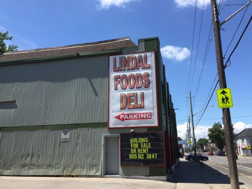
Hidden behind it’s green shell is an old car dealership complete with a car ramp to the second floor

IMG_4086

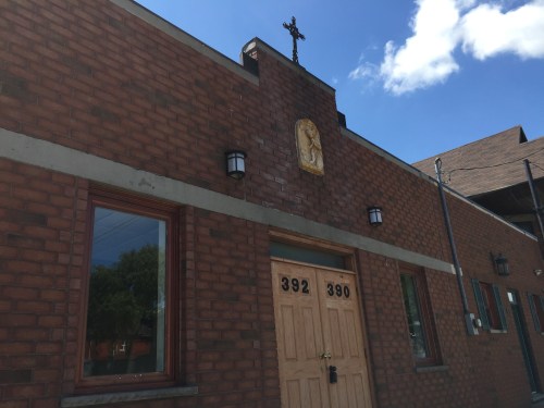
The overlooked Our Lady Of Glastonburty Orthodox Church with little ornament on an expansive street of traffic

IMG_4084

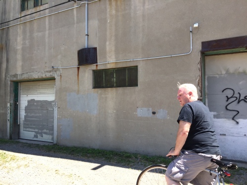
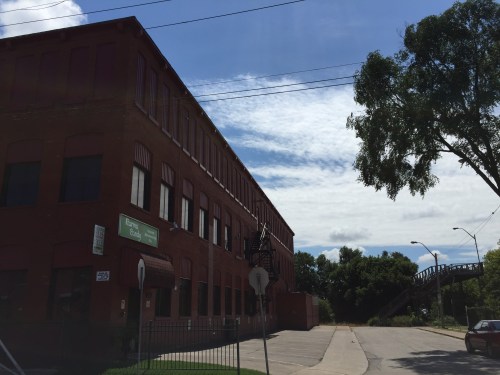
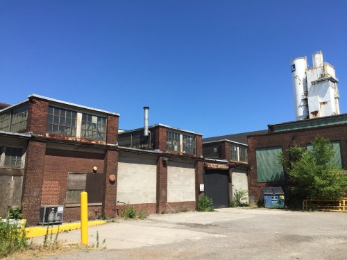
Bill giving me a history lesson about the building that was once Mills Lighthouse

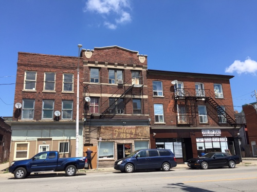
Our first notable stop was the Cannon bike lanes. There we stopped at points to discuss laneway housing, an old car dealership for sale, and a subtle little church easily missed by car.

Laneway housing is something Hamilton needs more of. They add density, character to neighbourhoods, and help increase the city’s building stock in an unobtrusive way (just to name a few of the benefits). Bill’s firm, TCA, did a study on Laneway housing in conjunction with the city and you can read it here.

IMG_4090.JPG

Moving day at a row of apartment buildings just West of Barton and Wenthworth

Next we made our way to Barton. We saw a street on the turn around. Although Barton faces many obstacles, we are seeing pockets of growth and investment sprinkled throughout. Many barriers are still in the way, but there are encouraging signs almost anywhere you look.

IMG_4094

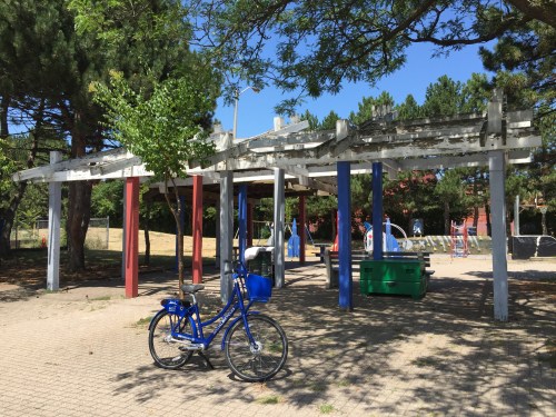
Lawanda in front of a post and beam pavilion at Birge Park

IMG_4095.JPG

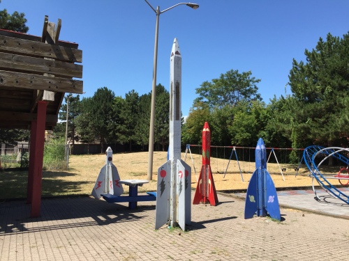
Rocketships of wooden wonder

IMG_4097

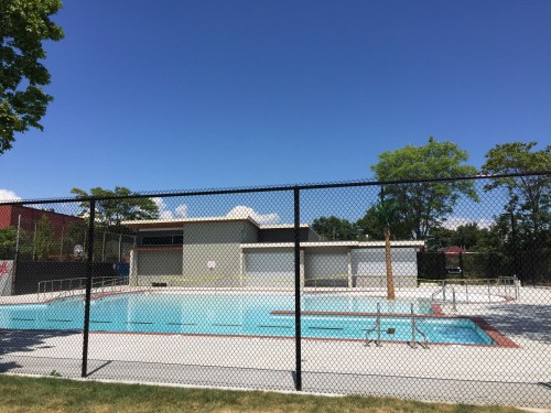
The new pool at Birge Park

We cut through some more alleys and streets before reaching Birge Park. This small park just received a makeover, which includes a new wading pool and change room building designed by Kathryn Vogel Architects. The building has a contemporary feel to it with its overhanging rooflines and stucco accents, while the pool is nothing short of functional as well as aesthetically pleasing.

IMG_4103.JPG

Karma Candy Factory

IMG_4106.JPG

The Galley Pump Tavern. A local favourite.

Continuing north, we passed Karma Candy factory, the Emerald Street Footbridge, some local watering holes, and numerous other businesses sprinkled throughout the area. The history in the North End is deep. There’s so much to discover that you can’t find it all in one bike ride. It would take many. I was curious about everything and I couldn’t keep track of it all.

Then came Burlington Street. It’s a different world. Trucks zooming by. Potholes like craters on the moon. We had to weave through areas like a downhill slalom just to get to our destinations.

IMG_4109.JPG

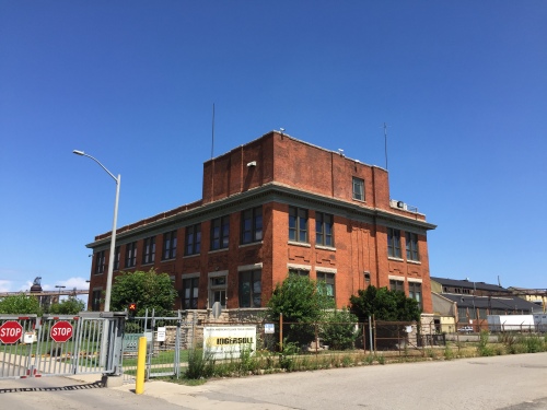
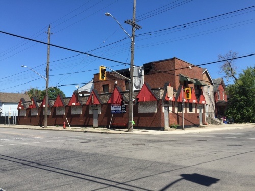
A handsomely detailed early modern office building that once housed Stelco offices.

IMG_4107.JPG

IMG_4110

POV from Lawanda’s perspective

IMG_4108.JPG

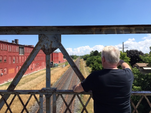
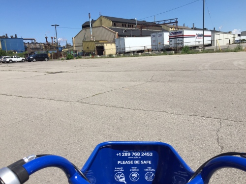
Bill discussing the port lands

We stopped by a handsome old Stelco office and made our way down closer to some of the ports. I wanted to ask Bill what his opinion is regarding the future of our Waterfront since it’s a hot topic in this city. He had differing opinions on what Pier 7 and 8 should look like and that more port lands should be accessible like they once were. After 9/11 security concerns changed that, he said, and the ports became impossible to access. I forgot what the world before 9/11 looked like.

IMG_4112.JPG

The former, recently charred Hamilton Hells Angels clubhouse (and before that the Gage Tavern) at Gage and Beach.

Before we knew it we were at Gage and we decided to cut south. We passed the recently closed Hells Angels HQ and made our way past more industrial buildings scattered amongst housing on Beach road. One thing I noticed was the many simple, functional, modern buildings sowed about the area. We need to do more to reuse these diamonds in the rough, as many now sit completely or partially vacant.
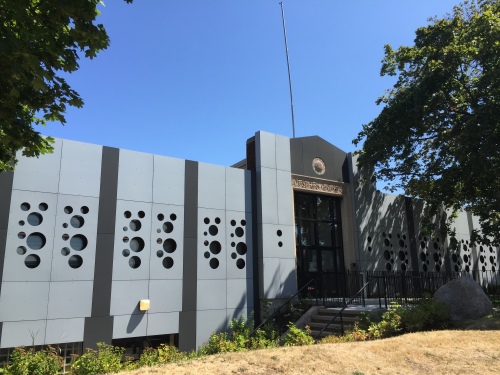
IMG_4113.JPG

Hamilton Moderne

IMG_4115.JPG

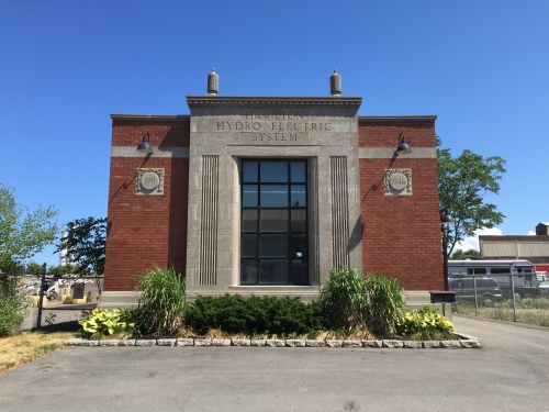
A beautiful Hydro Electric Station turned office building on Sherman with classical features, detailed reliefs, and ornament

IMG_4120.JPG

IMG_4122.JPG

A swiss cheese makeover at Victoria Ave

IMG_4124.JPG

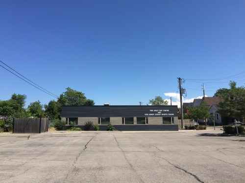
The Repite Centre, refaced by Greg Sather in 2005.

Next was Sherman. We rode past Cotton Factory and discussed its impact, the history, architecture, and the work ecosystem inside it. We also passed some charming early modern buildings on Sherman. I was too busy keeping my eyes on the road to take too many photos, but I certainly want to go back and look at more of what we saw that day.

The tour kept going. It was a long day. 21 kilometers were travelled. Lots of liquids were consumed. I won’t keep you much longer, because pretty soon this article is going to be as tiring as our bike ride. We explored a lot of the city and much of it is hard to retrace.

You know what was one of the best things about the ride? Taking a SoBi bike. If you haven’t yet tried one, you should. They are convenient, easy to use, and offer a better way to travel about the city. Those little blue machines are one of the best investments this city ever made. Don’t believe me? Sign up and let me know what you think. I promise you won’t be let down. And you’ll probably become hooked (like me). I barely even drive my car anymore.

1 Comment

Filed under Economy, History

PHOTO OF THE DAY – June 13th

20130613-181644.jpg

Hamilton Fire Station 1 – 35-44 John St N, Hamilton

Leave a comment

June 13, 2013 · 6:17 pm

The Hamilton Conservation Authority’s Veldhuis Project is moving forward

In partnership with the City of Hamilton, The Hamilton Conservation Authority is redeveloping a brownfield site along the Desjardins Canal into public green space.

The site is located at the old Veldhuis Greenhouse property that runs along the Desjardins Canal on King Street East in Dundas, just north of Cootes Drive. The area was once home to a greenhouse made famous for it’s variety and quantity of cacti.

image-15

The Veldhuis Project will cost an estimated $3 million, with the funds going towards the redevelopment of the one-hectare property, as well as remediation of the canal.

The project is part of the Hamilton Conservation Authority’s plan to create the Dundas Eco-park, which will be a part of the Cootes to Escarpment Park System. The 1300-hectare urban park will provide the only continuous habitat connection from Lake Ontario to the Escarpment.

Designed by landscape architects G. O’Connor Consultants, the redeveloped brownfield site will consist of a meadow, both an asphalt and limestone pathway, boardwalk lookouts, a pavilion, restored woodlands, and public art.

The only remaining piece of the old greenhouse still intact is the two-storey red brick chimney.

image-18

Due to Chimney Swifts, a protected at-risk species actively nesting in the chimney, it has been resolved that the chimney will remain as a site element. An eight-by-eight meter shaded structure that will resemble a greenhouse – a tribute to Veldhuis – will be situated along the asphalt walkway and within view of the chimney.

Development concept courtesy of The Hamilton Conservation Authority

Concept courtesy of The Hamilton Conservation Authority

The green space will also feature a pedestrian boardwalk against the edge of the canal, complete with a fabric sail-style shade structure, interpretive signage, and ‘industrial’ bench seating. The boardwalk’s design is an attempt to bring the canal’s rich history back to the site for those who walk the pathways and canoe the canal.

Concept courtesy of The Hamilton Conservation Authority

Concept courtesy of The Hamilton Conservation Authority

Along with the remediation of the Desjardins Canal, floating islands for nesting waterfowl will be implemented, as well as restored riparian edges and an enhanced riparian outlet.

On King Street, the two-meter wide municipal sidewalk will be extended and a new crosswalk with painted markings will be added to connect the Veldhuis green space with Martino Park to the north.

One of the remaining challenges facing this redevelopment is the proposal to close King Street at Olympic Drive. The plan is to remove the existing road to create a turtle nesting area, extend the pathway, and add an additional boardwalk.

Work on the Veldhuis Project is set to begin later this summer.

Leave a comment

Filed under Architecture, Development, Economy, Heritage, History

PHOTO OF THE DAY – April 24th

PHOTO OF THE DAY - April 24th

Terraces on King – 260 King St E, Hamilton

1 Comment

April 24, 2013 · 9:27 pm

Changes coming to Gore Park

Call it the end of an era, a new chapter, or a failure. No matter what you call it, change is coming to Gore Park.

As of January 9th, developer Wilson Blanchard was cleared by City Council for the demolition of 18-28 King Street East – a series of four row houses on the south side of Gore Park – to make room for a mixed-use condominium development. However, after community opposition, Blanchard has decided to withdraw his application to demolish all but two of the buildings. But was this a fair compromise?

This slideshow requires JavaScript.

These four Victorian-era row houses were erected between 1840 and 1875. Renowned architect William Thomas (famous for St. Lawrence Hall in Toronto) designed the three-storey buildings, 18 and 22 King Street (which Blanchard plans to keep). The buildings facades, with intricately designed cornices and arcade-style windows, are still intact.

All four historical buildings, however, should have been designated as heritage buildings by Heritage Canada, which would prevent them from being demolished.

The City of Hamilton’s Heritage Committee’s track record for preserving buildings is far from flattering. In 2006, the Province had to step in and save the Lister Block after it was slated for demolition. If it weren’t for community outcry, all four buildings – instead of two – would currently be under the wrecking ball.

These row houses, sometimes referred to as “streetwalls”, are integral to the streetscape of Gore Park – the city’s Civic Square.

The rows of these attached structures simulate continuity, essentially enclosing the square, therefore defining the space for the activities Gore Park can host. Like the Gore Park Master Plan – a pedestrian-friendly plaza closed off from traffic.

However, the outcome isn’t all that bad. Artist renderings released by the developer reveal the infill of buildings at a three-storey height beside what would be the two remaining buildings, as well as taller mixed-use buildings superimposed into the adjacent parking lot that sits idle.

Another positive outcome from this compromise is the active role the community played in shaping their city’s future development. This role is an important element in achieving a sustainable city.

2 Comments

Filed under Architecture, Development, Economy, Heritage, History